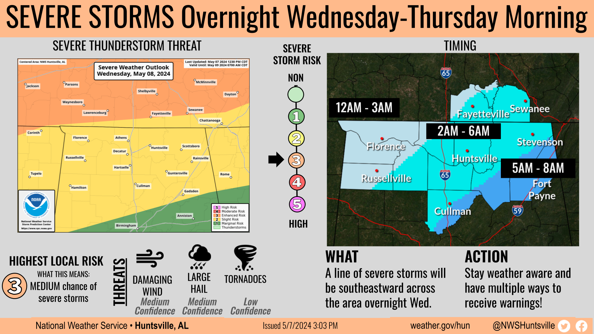
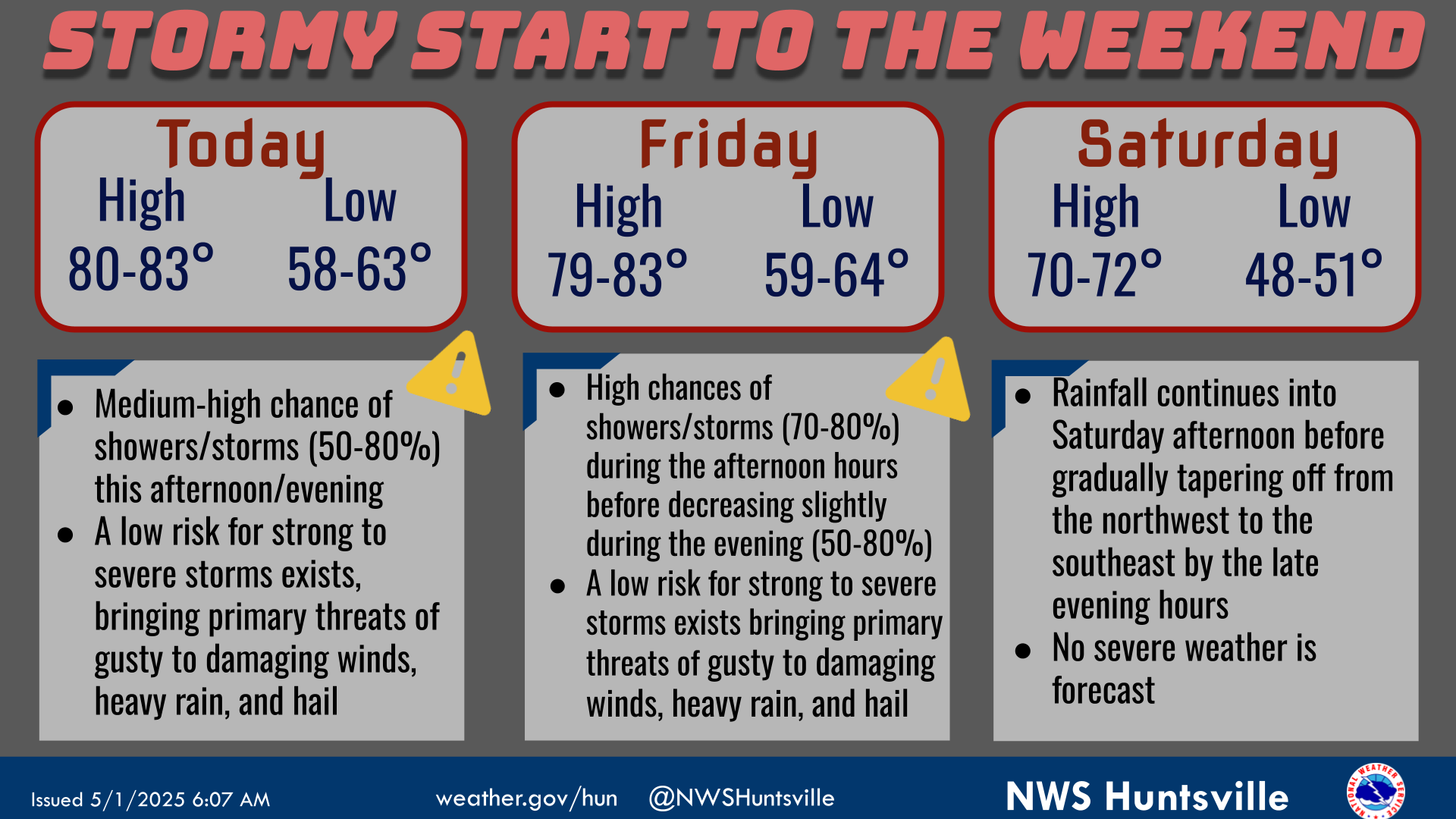
Here's your weekend weather outlook! Highs will continue to warm into the 60s/70s through Sunday. Lows in the 50s/60s are forecast until a cold front sweeps through the region Sunday night. This will bring medium to high chances of rain Sunday night and MUCH colder early next week.
This graphic contains daily climate data (climate normals and records) for today for the sites listed. The legend is in the upper left portion of the image. The current normals period is 1991-2020.
❄️Did you know that Huntsville has only had measurable snow on Christmas twice in the period of record which goes back to 1894? There was 2.50" in 2010, which is the daily record, and 0.3 inches in 1989.
Note: "N/A" or "MISG" will be displayed if values are not available. In the LOCATION column, click on links for a list of recent observations at sites of interest. In the WIND column, VRB is "variable" and G is "gust". Wind speeds are in MPH. In the BARO (pressure) column, values are in inches. In the REMARKS column, HX is "heat index", WCI is "wind chill index", and VSB is "visibility" (if shown).
Text Product Selector (Selected product opens in a new window)